Petrified National Park

Overview

Established in 1906, Petrified Forest National Park is located in northeastern Arizona and covers 229 square miles.  The park is famous for its abundance of petrified forest, fossilized wood, and colorful landscape.

Accessibility

The park can be driven by car to most major vista points with many short developed trails.  Via the south entrance is the Rainbow Forest known for its colorful petrified wood, and houses a museum with paleontology exhibits.  In the center of the park are petroglyphs of Newspaper Rock and ruined village of the Puerco Peublo tribe.  Via the north entrance is the Painted Desert Inn that was built in 1930s and is now a museum with murals from the Hopi tribe.

The park’s operating hours are from 9am to 5pm so please plan accordingly. Additionally, the park only offers tent camping that requires a 1 mile hike as well as a permit, so please check with the https://www.nps.gov/pefo/planyourvisit/index.htm.  The closes city to the park with lodging is Holbrook and there are many options for lodging at low rates.

Park Highlights

Blue Mesa

Blue Mesa

Blue Mesa – This is a 0.9 mile loop trail near the middle of the park that offers a unique experience of hiking among badland hills of bluish bentonite clay as well as petrified wood. This trail tops our list of places to stop at Petrified Forest because of its easy hike and spectacular vibrant hills.  It is a must stop if you only have half a day at the park.

Teepee Point

Teepee Point

Tepees Point – We drove through Tepees vista point at the perfect time during sun-setting, and this lighting brought out the amazing colors of the badland hills. If you’re lucky during your drive through the park, make sure you time it correctly to get the perfect lighting on the hills at Tepees. 

Jasper Forest – Jasper Forest is one of the largest deposits of petrified wood in the park. We did not complete the 2.5 miles hike into the Jasper Forest, but instead hung out at the overlook and enjoyed our lunch. From above, this vista point provides an amazing view of the beautiful landscape that Petrified Forest offers.  If you have the time, we would recommend exploring this trail.

Painted Desert Overlook – This is a 3 miles drive from the north entrance with many vista points that highlight the colorful desert sands.  This is a good place to be if you’re looking to catch a stunning sunrise or sunset on a clear day.  

We also stopped at the following locations while driving through the park: Newspaper Rock to see the petroglyphs; Agate Bridge to see the 110 feet long petrified bridge; and the Rain Forest Museum to see the dinosaurs fossils and learn more about the park.

2018_Petrified-99.jpg

Lodging

The closest city to the park with lodging is Holbrook, which is 25 miles west of the park. There are RV parks and plenty of inns and motels to choose from.

Closest Cities to the Park: 

The closest major cities to fly into to visit Petrified Forest National Park are Albuquerque, NM, and Phoenix, AR. 

Recommended Length Stay: 2-4 days

Would we be back?  Maybe, if we find ourselves driving near the park.

For more photos, please click here.

Grand Canyon National Park

Overview

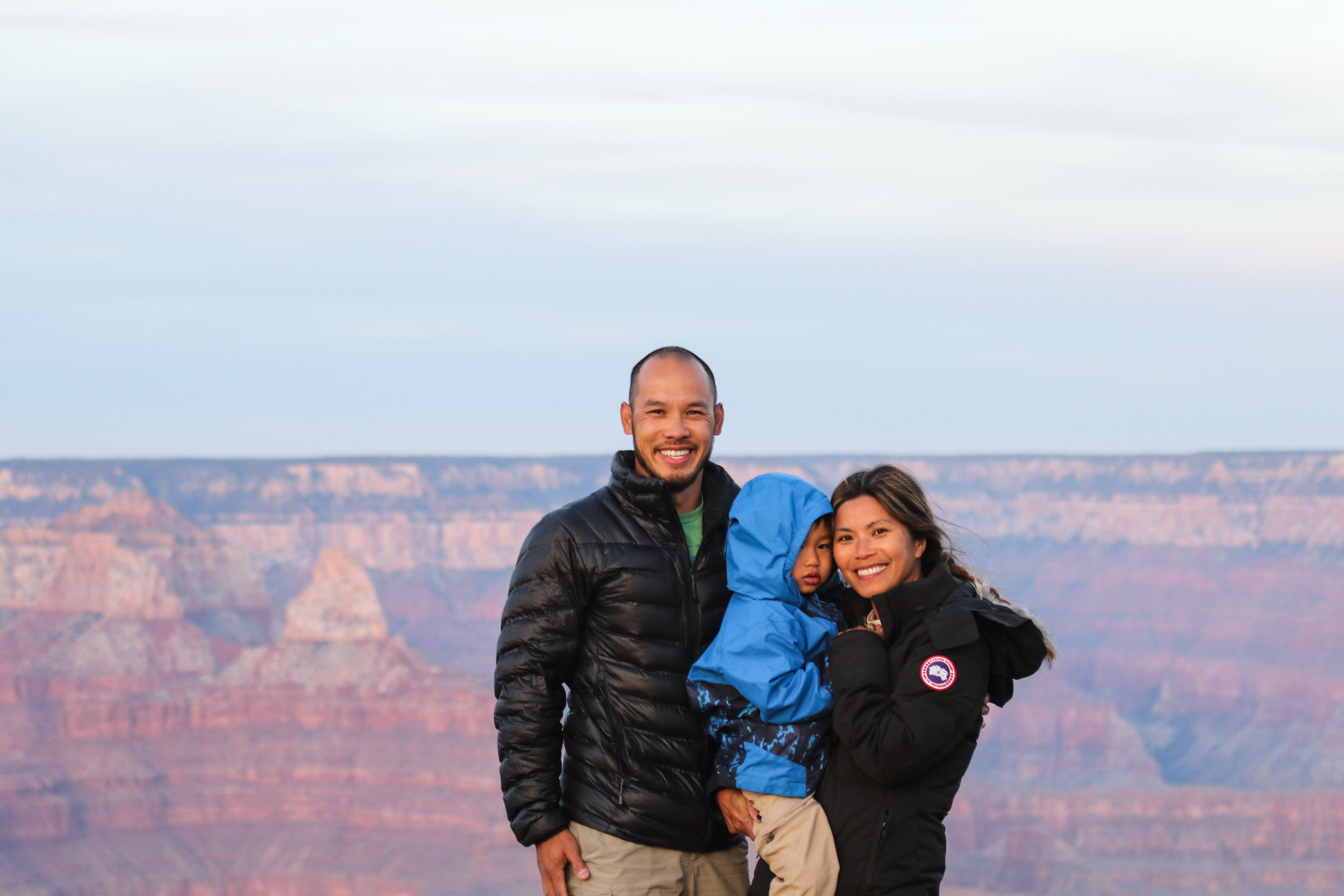
Often considered as one of the Wonders of the World, Grand Canyon National Park covers 1.2 million acres of land and is the second highest visited national parks. Designated as a national park in 1919, the Grand Canyon became a World Heritage Site by UNESCO in 1979. The Grand Canyon is world famous for its enormous colorful layered of rocks that exposes millions of years of geological history. President Theodore Roosevelt visited the park and said: “The Grand Canyon fills me with awe. It is beyond comparison—beyond description; absolutely unparalleled through-out the wide world.”

Accessibility

2018_GrandCanyon-16.jpg

South Rim Drive

Grand Canyon is primarily accessible via the South and North Rims with the majority of the park classified as backcountry. With some 30 miles of the South Rim being accessible by road and is slightly more than 4 hours east of Las Vegas, the South Rim accounts for 90% of park visitors each year. Additionally, due to elevation and supporting facilities, the South Rim is open year round while the North Rim is often close during the peak winter season.

Park Highlights

2018_GrandCanyon-149.jpg

Bright Angel Trail

Bright Angel Trail – This is a 10 miles one way trail that descends over 4,300 feet of elevation at an average grade of 10%. This switch back trail ends at the Phantom Ranch and will take you to the Bright Angel Campground. Camping at Bright Angel and Indian Garden campgrounds requires a permit issued by the Grand Canyon National Park Backcountry Information Center.

Please plan very far in advance if you would like to camp overnight at any of these campgrounds. We had limited time and a toddler on this trip so we did a 3 miles round-trip on the Bright Angel trail. Although the trail was packed, the view down and up the canyon was amazing. We will definitely be back to hike and camp at the bottom of the canyon in the future.

Great View Points: While at the park, we spent sometime at the Mather Point, Yavapai Observation Station and Lipan Point viewpoints to catch both sunset and sunrise. These viewpoints are very easily accessible and gave us an amazing front-row seat of the magnificent Grand Canyon.

Lodging

2018_GrandCanyon-17.jpg

Campgrounds – There are a lot of campgrounds at Grand Canyon. We stayed at Mather campground. Although it was November, the campground was still packed with RVs and camper trailers during our visit. From a reasonable size grocery store to a handful of restaurants and hotel options inside the park, Mather Campground will make you feel like you’re in a small town rather than a remote national park.

Hotel Lodging can be found here.

Closest Cities to the Park: The closest big city to fly into to visit Grand Canyon via the South Rim is Las Vegas.

Recommended Length Stay: At least 3-5 days to hike and explore some of the famous areas of the park. For those who can commit and plan very far in advance, a 5-7 days camping trip in the canyon could be an exciting and memorable adventure.

Would we be back?  Definitely yes when Harvey is older and can carry his own gears for an unforgettable camping trip.

For more pictures, click here.

Death Valley National Park

Overview

Death Valley is the largest national park outside of Alaska with countless exploration and experiences to share for all ages.  The park covers 3 million acres of Wilderness that include majestic sand dunes, twisted and narrowed colorful canyons, rocky peaks, stunning salt flats, and more.   

Accessibility

All of the major highlights at Death Valley is wheel chair accessible and very kid friendly. You can literally see the beauty of Death Valley from your car or a quick walk outside your car.

Death Valley is close to 2 major cities (LA and Las Vegas) so getting here could potentially be a day trip if you leave early in the morning and stay late in the evening.

Death Valley is open all year around but summer is blazing hot and can get up to 130 degrees F so we recommend going in the fall or winter or early spring. We were here in November and it was 79 degrees during the day and cool at night. It was perfect weather.

Park Highlights

2018_DeathValley_a-227.jpg

Sand Dunes

Mesquite Flat Sand Dunes – Death Valley is home to 5 sand dunes, with one of them being perhaps the tallest in North America, Eureka Dunes. While at Death Valley, we visited Mesquite Dunes because it was 5 miles drive from Stovepipe Wells Campground.  Mesquite Dunes is in the middle of the valley and offers a stunning 360 view of the different mountain ranges that overlook the park.  Harvey loved the dunes so much that we often found him swimming down the dunes and rolling wherever gravity takes him. If you plan to visit the dunes, please bring sandals and be prepare to hike if you want to be on/near the highest peak.  

Badwater Basin

Badwater Basin

Badwater Basin– This is the lowest point in North America, 282 ft below sea level.  The basin is a surrel landscape of vast salt flats.  Harvey was fascinated by the salt and had to taste test a few areas of the flats. He also enjoyed walking on top of where the salt raises up on the flats.  

Dante’s View – A breathtaking drivable viewpoint in the park that offers a mountain-top overlook that is more than 5,000 ft above the floor of Death Valley. This vista point is highly recommended for both sunrise and sunset on a clear day. 

Artist’s Drive – This is a scenic 9 miles loop drive that takes you through colorful volcanic and sedimentary hills. Towards the middle of the loop, there are hiking trails that allows you to see the colorful sediments that creates the beautiful mounts.  Unfortunately we only had 1 hour to spare for this drive and therefore didn’t get a chance to hike any of the trails.  We will definitely be back and hike a trail or two in the future.

Zabriskie Point

Zabriskie Point

Zabriskie Point – This is a beautiful vista point for catching both sunrise and sunset on a clear day.  The beautiful golden colored badland hills is probably one our suggested must-see sights because of its ease of accessibility, which is a 0.25 mile hike from the parking lot that can’t be missed if you’re coming to the park from the east entrance, Las Vegas.

Twenty Mule Team Canyon – If you’re interested in a fun drive through beautiful golden canyons, the Twenty Mule Team Canyon loop is an easy one not to miss.  This loop is less than 5 miles east of Zabriskie Point, and offers a close look at Death Valley’s vibrant golden canyons. There are a few areas with steep and curvy trails, so please leave your 25-ft trailer at the campground.

Two other areas that we visited while driving through the park were Devil’s Golf Course and Salt Creek.  Devil’s Golf is a quick drive to and checkout point and Salt Creek has a 1 mile loop walk on top of a creek that runs through the park.  During the wet season, pupfish can be found at Salt Creek. 

We were unsuccessful at being able to visit Titus Canyon and Mosaic Canyon.  The drive-in trail to the trailhead for Mosaic Canyon is under renovation, so if you still want to visit the canyon, you’ll have to hike an additional 2 miles from the main road to the trail head. Titus Canyon requires a 1 mile off-road drive from the main road to the trailhead so please be prepare for some rocky driving. I would recommend an 4x4 with some clearance on this road.  If you just have a sedan, please drive slowly and navigate around large rocks.   

Lodging

2018_DeathValley-12.jpg

Wildrose Campground – We stayed at Wildrose campground because it was the closest campground from the west entrance.  Wildrose campground is one of several free campgrounds in the park.  Wildrose offers a phenomenon snapshot of the milkyway because of its pitched black skies. We would recommend staying at this park if you’re coming from the west entrance and want to see a lit up sky.  The road to this campground is not well maintain and is pitched black at night so please drive slowly and be prepare to navigate around potholes. 

Stovepipe Wells Campground – We stay at Stovepipe Wells our second night because it is near some of the places we wanted to visit, like the Mesquite Flat Sand Dunes and Mosaic Canyon.  Additionally, Stovepipe Wells also has gas and facilities if you’re looking for a warm shower and a convenience store.   

Furnace Creek Campground – We then stayed at Furnace Creek because of its vicinity to additional places that we wanted to visit near the east side of the park, such as the Salt Flats and Zabriskie Point.  Furnace Creek is a very large campground, but do fill up during peak season so please plan accordingly and come early to snatch a site if you don’t already have a reservation. The Ranch is a resort down the road with a very large and warm swimming pool and shower for $5/person, and the main visitor center is next door to the campground.  

Closest Cities to the Park: 

The closest major city to the east entrance of Death Valley is Las Vegas, which is 123 miles.  Closest major city to the west entrance of the park is Los Angeles, which is 218 miles south west of the park.

Recommended Length Stay: at least 3 days and if possible 5 days or more.

Would we be back?  Definitely yes and spend more time in the park.

For additional photos, click here.

Joshua Tree National Park

Overview

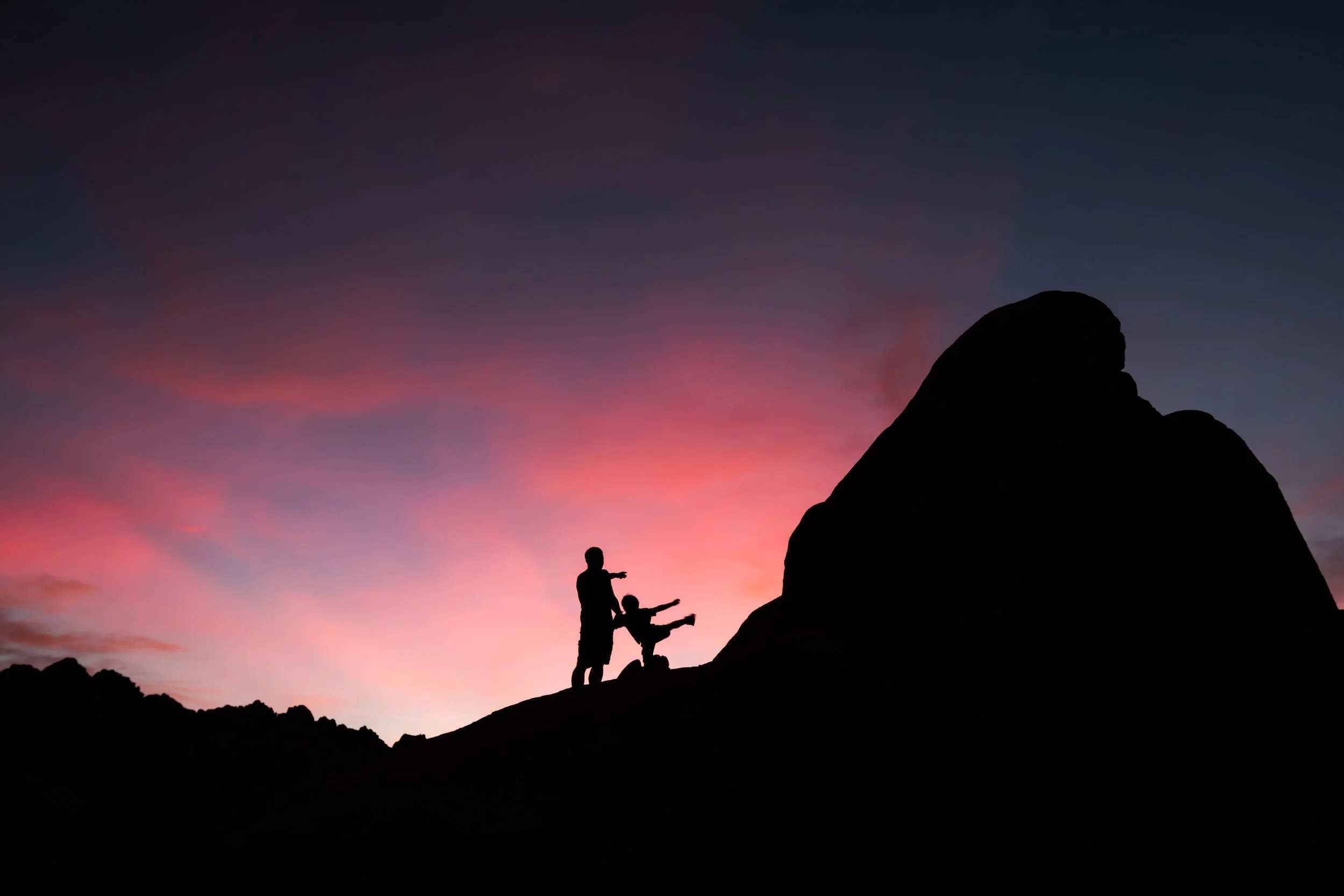
Covering approximately 800,000 acres, Joshua Tree National Park is considered a desert wilderness where the high Mojave Desert meets the low Colorado Desert.  This desert can be described as smooth large boulders, rugged mountains and desert plains covered with Dr. Sues’ trees, Joshua trees.  Each year, the park welcomes approximately 2.8 million visitors to activities like hiking, camping, day and nigh photography, rock climbing, and the simple pleasure of desert scenery and wildlife.

Accessibility

Joshua Tree is relatively accessible by car and most of the roads inside the park are paved. Joshua Tree is open all year around but the best time to go is during the fall and winter because the weather is cooler than the spring and summer which can be extremely hot, can be up to 120F. We went during November and it was perfect weather around 75-80F during the day and around 60s at night.

Park Highlights

Forty-nine Palms Oasis

Forty-nine Palms Oasis

Fortynine Palms Oasis – This is a 3 miles round trip with 300-ft of elevation gain each way.  At the end of the hike is a rocky canon covered by green palm trees.  Even though it was November, temperature throughout the hike felt like mid 80 degrees.  It is suggested that you do not attempt this hike when it is hot out.

Barker Dam Hike – This is a 1.1 mile round trip loop that takes you to a man-made water tank/dam that was built by the early cattle ranchers.  Although the hike is deep into the park, the entire hike is flat, easy and scenic at the dam. 

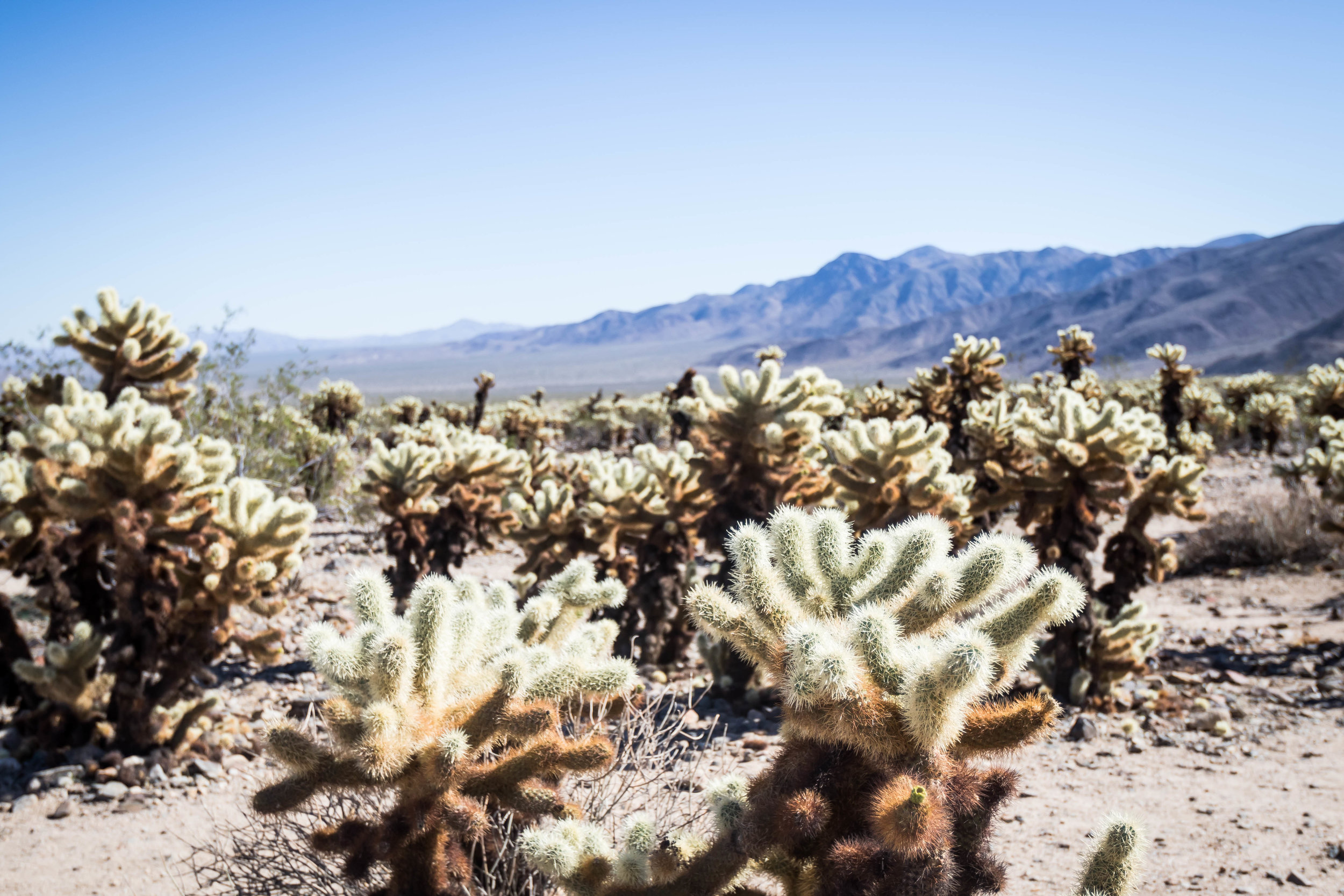
Cholla Cactus Garden – This is a ¼ mile loop with thousands of concentrated cholla cactus, also known as jumping cactus.  Please be very careful not to come close to these cactus and where  

2018_JoshuaTree-178.jpg

Cholla

Keys View –  This is a beautiful viewpoint on the Little San Bernardino Mountains that gives visitors a panoramic view of the Coachella Valley.  It is popular place to hangout and enjoy both sunrise and sunset.  

Skull Rock – Along the main east to west park road is Skull Rock, which is a fun rest stop when driving through the park. Skull Rock can be seen just across the road and there are many fun nature trails all around this rock to explore.  Harvey had a blast climbing in between the boulders surround Skull Rock.   

Lodging

2018_JoshuaTree-10.jpg

BLM Site

Joshua Tree BLM – We arrived in Joshua Tree National late Saturday night during what’s considered peak season, the fall and early winter, and therefore could not find a campsite in Indian Cove. We decided to experience our first BLM camping.  There are lots of BLM lands near Joshua Tree and you can find them on Google Map.  Overall, the BLM near Joshua Tree exceeded our expectation because it was free and there were quiet a bit of other people around us.  If you decide to BLM, please make sure your vehicle can handle rocky and sandy roads.

2018_JoshuaTree-133.jpg

Indian Cove Campground

Indian Cove Campground – We spent the remaining two nights at Indian Cove Campground because the campsites were situated right next to beautiful large boulders.  The sunsets at Indian Cove was breathtaking because of how the sun’s colors are reflected off the soft towering boulders surrounding each campsite.  There are many campgrounds in Joshua Tree and most have many first come first serve basis campsites.  If you are planning to visit during peak season, which is from the fall to spring seasons, please plan to arrive at the campground early to snatch a campsite, especially on the weekends.  Please check with the https://www.nps.gov/jotr/planyourvisit/campgrounds.htm for additional information regarding campgrounds in Joshua Tree National Park.  

Closest Cities to the Park: 

The closest big city to fly into to visit Joshua Tree National Park is Los Angeles. 

Recommended Length Stay:  At least 3-5 days to hike and explore the majority of the park.

For more photos, they can be found here.

Pinnacles National Park

Overview

Although it was established as a national monument in 1908, it wasn’t until recently that Pinnacles became a national park, 2012.  The park is located in central California, and is divided by rocks formation into the East and West Divisions.  There are only foot trails that connect the East and West Divisions, no road.  A notable attribute of Pinnacles National Park are the many caves that are homes to many species of bats, some of which are only found at Pinnacles.  

Accessibility

There are two entrances to Pinnacle National Park, East and West.  Both roads are small and it is best to enter the park during the day-time because the roads are not well lit.  There are a few vista points that are drivable to, but the majority of them require some hiking.  Pinnacle has two visitor centers, one on the East and the other on the West.  Camping is only allowed at East Pinnacles. 

2018_Pinnacles-58.jpg

Park Highlights

Wild animals and bats – This park is one of Harvey’s favorite parks because of the wild animals that we saw everywhere.  From the dozens of deer feeding no more than 25 feet from our campsite to countless bats that come out at night to feed on the bugs, Pinnacles is a home to a lot of animals, and Harvey had a blast looking at them.   

Bear Gulch trail – This is a 3 miles round trip hike that took us through a cave and ended with a reservoir.  This is a kid friendly trail and we saw an entire school bus of kids hiking this trail for a school field trip. It was Harvey’s first cave hike and he enjoyed the dark and low ceiling navigation. We definitely recommend this hike especially if you have not hiked through a cave before.  Make sure you bring a flashlight.  

2018_Pinnacles-171.jpg

Old Pinnacles Trail to Balconies Cave – This is a 4 miles round trip hike and again took us through a cave.  We skipped the uphill balconies portion of the hike, because we weren’t sure if Harvey could handle another 0.8 miles hike.  The highlight of this hike was the ¼ mile hike through dark and tight spaces. The cave for this hike is definitely a little more tricky and harder to navigate because of the tight spaces. The trick is to follow the white arrows and some can be challenging to find in the dark.  Again, please make sure you bring a bright flashlight. 

Lodging

We stayed at the RV campground at Pinnacles because we wanted to plug-in our trailer and keep the freezer/fridge cold.  It was challenging to find an RV site on a first come first serve basis for more than 2 consecutive nights because 1/3 of the RV campsites were closed because of falling trees. As for tent sites, the park has quite a bit so it shouldn’t be a challenge visiting without making prior reservation. 

Closest Cities to the Park: 

The closest major city to Pinnacles is San Jose, California, which is 85 miles north of the park. You can fly into SAN international airport and drive to Pinnacles in 2 hours.  Please be prepared to deal with terrible traffic during rush hours so please plan accordingly.

Recommended Length Stay: 3-5 days

Would we be back?  Maybe when Harvey is older and can handle the dryer climate as wells longer hikes.

For more photos of the park, click here.
Channel Islands National Park

Overview

The Channel Islands form eight-island off the coast of Santa Barbara and Ventura. Five of the islands are part of the Channel Islands National Park, and the waters surrounding these Channel Islands are part of the Channel Islands Marine Sanctuary.  As the result of isolation over thousands of years, these islands have become homes to many unique animals and plants that can only be found on the islands.   

Accessibility

2018_ChannelIslands-13.jpg

The five islands that make up the Channel Islands National Park can only be visited via boat with the Island Packers Cruises. Islands Packers depart from two locations, Oxnard and Ventura, and a one-way trip to each island takes roughly 1 hour. June through August is considered peak season and tickets to visit any of the islands are limited, so please plan in advance and book you ticket at http://islandpackers.com/.

TIPS: If you’re going to multiple islands, make sure you go to the right port. There are 2 ports: Oxnard and Ventura. Check twice, cut once.  

2018_ChannelIslands-203.jpg
2018_ChannelIslands-217.jpg
2018_ChannelIslands-220.jpg

Park Highlights

2018_ChannelIslands-57.jpg

Santa Cruz

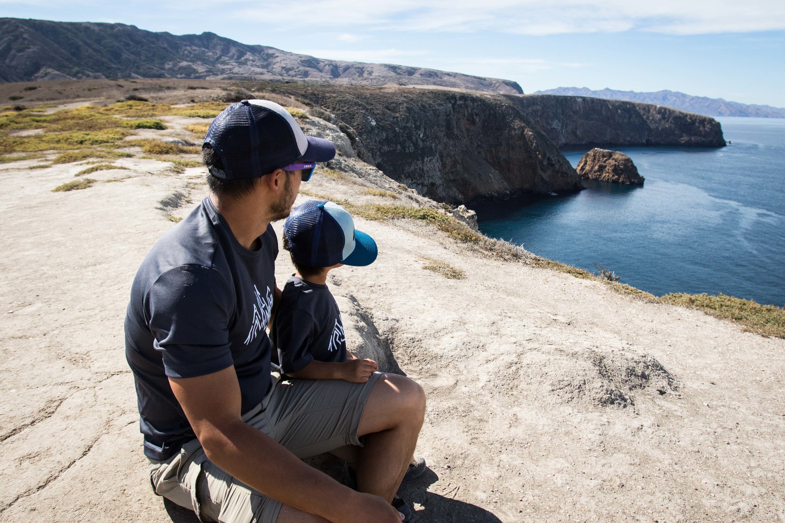
Santa Cruz Island – At about 24 miles long and 6 feet wide, this is the largest of the five islands.  We visited Santa Cruz on our first visit to Channel Islands and had a blast. The boat ride was a lot of fun as we had the chance to see many dolphins next to and behind the boat chasing the waves. On the island, the water was crystal clear on the dock and the beach with countless number and variety of fishes and sea life. Although the water was in the 60s during our visit, there were many people snorkeling and kayaking.  You can rent or bring your own snorkeling and kayaking gears on to the island.  The island has lots of hiking trails and one campground that will require early planning if you are visiting during peak season.  There are lots of wildlife on that are unique to the island, such as the island foxes, and they are very friendly.

2018_ChannelIslands-313.jpg

Anacapa Island

Anacapa Island – At about five miles long and a ¼ mile wide, this is one of the smaller islands.  We visited Anacapa on our second day and was able to hike the entire island within the first half of the day. The island has a campground with limited facilities but it would be a photographer’s dream to shoot the night sky on a clear day. If we had time, we would have camped here because it’s so unique and beautiful island. Walking around the island made us feel so relax and calm and somehow makes you feel like you’re back in time of Anne of Green Gables. We highly recommend this island.

There are other islands we did not visit but wish we had time to visit them all. We will be back to visit them in the future!

Lodging

We stayed at a hotel in Oxnard, CA, and booked day tours to both Santa Cruz and Anacapa.  

Closest Cities to the Park: 

The closest big city to fly into to visit Channel Islands is Los Angeles, LAX. 

Recommended Length Stay:  At least 3 full days tour of any of the islands since they are so unique and beautiful. Minimum is 2 days.

Would we be back?  Definitely yes, we loved it!

For more photos, they can be found here.

Sequoia National Park

Overview

Located in the southern Sierra Nevada, Sequoia National Park was established in 1890 to protect 404,064 acres of forested mountainous terrain.  This park is notable for the giant sequoia trees, including the General Sherman tree, the largest tree on Earth. 

Accessibility

The park is relatively accessible by car where paved roads allows any visitor to access most vista points. The park is open year round, but not all facilities will be available, specifically in the winter.  Please check with the nps site for additional information regarding what facilities as well as roads are accessible.

Many of the trails in the giant forest are wheel chair accessible so this park is great for kids in strollers but they might not want to stay in a stroller due to the big trees!

Park Highlights

2018_Sequioa_Kings-114.jpg

walking on morro rock

2018_Sequioa_Kings-133.jpg

top of Morro Rock

  • Morro Rock - We stumbled upon Moro Rock while driving in search for clusters of sequoia trees and the sunset view above the forests’ canopy was stunning.  Moro Rock is a large granite dome with over 350 steps made up of concrete and stone allows us to climb up to the top and experience the amazing beauty of the Sierra ranges at sunset. This is a must visit vista point for either/both sunset and sunrise experience, but will require careful planning depending on where you are staying because of winding roads that may seem short but will take much longer to drive through.

  • Generals Highway and the Giant Forest - Driving through the Giant Forest via the Generals Highway was magical and filled with oohs and aahs as we kept our eyes wide open in search for bigger and bigger sequoias.  Since the Generals Highway connects both Kings and Sequoia National Parks, taking this drive from the General Sherman tree to the Giant Forest Museum is a must. In this giant forest area, there are many hikes that are just amazing. We suggest hike big tree trail, Sherman tree trail and big bear trail especially in the morning!

2018_Sequioa_Kings_a-162.jpg

Lodging

We stayed at Azalea campground in the Kings Canyon National Park next door.  Azalea is a beautiful fist come first serve campground. Sequoia National Park has several campgrounds such as Lodgepole and Giant Forest, or the Foothills Area. It is best to check with the nps site for availability ahead of time before you pack your tent and sleeping bag. 

Closest Cities to the Park: 

The closest airport is the Fresno-Yosemite International Airport (FAT), which is about 65 miles south of the park, which equates to a 1½-hour drive.

Recommended Length Stay:  At least 3 days if you’re just planning to drive around the park, and at least 5 days if you’re planning to do some backpacking.

Would we be back? Absolutely, but with more friends and families next time.

For more photos, they can be found here.

King's Canyon National Park

Overview

Originally founded in 1890 as General Grant National Park to protect giant sequoia trees, the park was later expanded and renamed to the Kings Canyon National Park in 1940.  The park is located in the southern Sierra Nevada near Fresno, California. Kings Canyon offers rugged glacier-carved valley that more than a mile deep with beautiful features that include many 14,000-ft peaks, swift-flowing rivers and some of the world’s largest and oldest giant sequoia trees. Beside the many vista points down the long canyon winding canyon drive, Kings Canyon National Park boast countless long and scenic backpacking trails for those hungry for days in silent with nature’s peaceful landscapes. 

Accessibility

We were extremely lucky with our visit at Kings Canyon because we had the chance to drive through the largest part, the later expanded part of the park, of Kings Canyon on the last day before the road was closed for the winter season.  Although the park is opened year round, the vast majority of the park is closed for the winter due to unpredictable weather, so please check with the nps site and plan ahead.   

Overall the park provides is both friendly for those who like to drive and especially for those who like to hike. One of the most famous hike at Kings Canyon is the Rae Lakes Loop that starts at the end of the drive down the canyon. This is a 41.4 miles loop with over 6,000-ft of elevation climb to a breathtaking view of Rae Lakes. If you plan to do this hike during the summer, please make sure you make reservation through the nps site because permits are limited.    

Park Highlights

2018_Sequioa_Kings_a-106.jpg

Scenic Drive through King’s Canyon

Kings Canyon Drive - Driving through Kings Canyon was like go through a 5 hours stop and go rush-hour traffic afternoon. Every mile seems to have a must stop vista point.  Although our visit was in the dryer season for the park and most of the waterfalls have dried up, the entire drive down and up the canyon was exciting and picturesque. The winding roads and colorful rocks that fenced the drive on Kings Canyon Scenic Byway is definitely worth a day trip. 

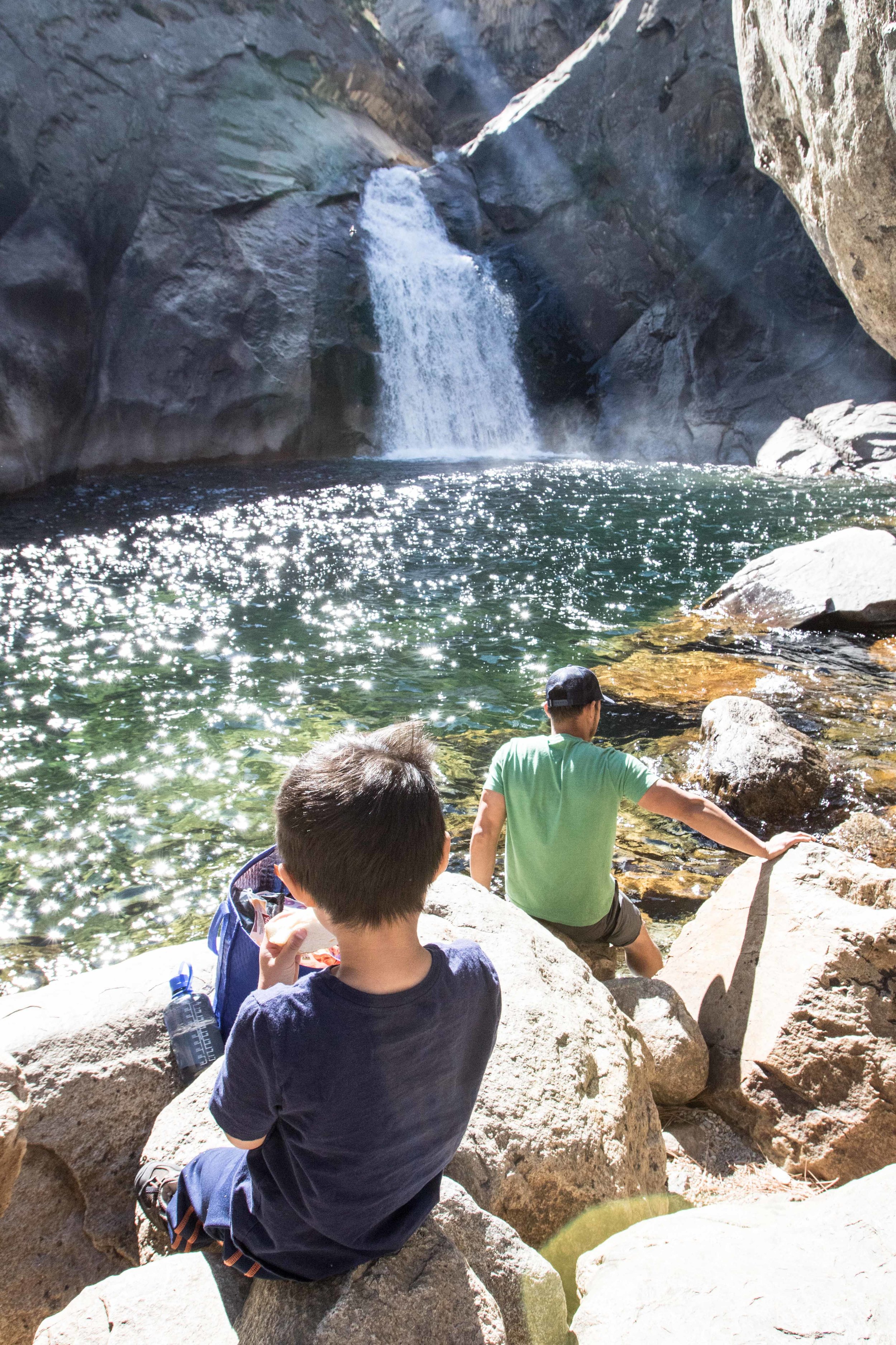
Roaring River Fall - While down the canyon we stopped by the Roaring River Fall for what that was supposed to be a 30 minutes lunch break but became an hour relaxation lunch spa experience. Since it was the dryer season, we were able to hike closer to the water and allow the soothing sound of cold glacier water falling on the smooth rocks relaxes our minds while we enjoyed our scrumptious lunch.  

2018_Sequioa_Kings_a-24.jpg

King’s Canyon WaterFall

2018_Sequioa_Kings_a-45.jpg

Roaring River Falls

2018_Sequioa_Kings_a-60.jpg

roaring River FaLLS

Lodging

We stayed at Azalea campground and found a beautiful fist come first serve campsite.  Azalea campground is open year round is in the part of Kings Canyon that was initially the General Grant National Park.  The campground is about 1 mile from the visitor center, hotels and cabins, restaurants, gift shop, and post office. This campground is surrounded by giant pine trees and situated next to the second largest standing sequoia in the world, General Grant.  If you are camping during the weekend, please plan to come early to snatch a campsite because the campground can fill up quickly.    

Closest Cities to the Park: 

The closest airport is the Fresno-Yosemite International Airport (FAT), which is about 65 miles south of the park, which equates to a 1½-hour drive.

Recommended Length Stay:  At least 3 days if you’re just planning to drive around the park, and at least 5 days if you’re planning to do some backcountry camping and hiking. 

Would we be back? Absolutely when Harvey is older and can backpack with us for more than 3 hours.

For more photos, they can be found here.